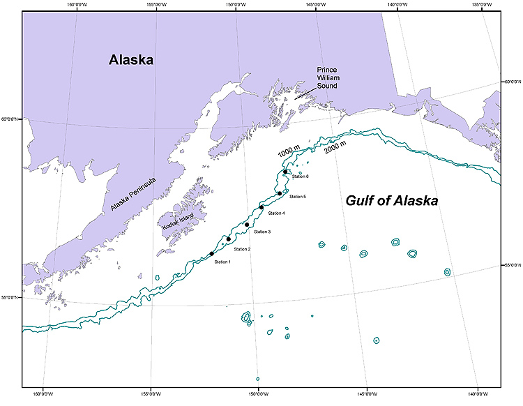
Figure 1. Map showing sites sampled along the continental shelf break in the Gulf of Alaska during the 2008 Mesopelagic Survey. Dark lines indicate the 1,000-m and 2,000-m contours.
|
Figure 1. Map showing sites sampled along the continental shelf break in the Gulf of Alaska during the 2008 Mesopelagic Survey. Dark lines indicate the 1,000-m and 2,000-m contours. |