Gulf of Alaska Biennial Groundfish Assessment Survey Completed
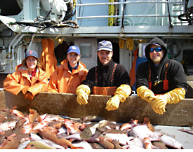
Figure 10. Alison Deary, Lisa DeForest, Todd TenBrink, and Jameson Gregg aboard the chartered fishing vessel Sea Storm during the 2009 Gulf of Alaska groundfish assessment survey.
The sixth in a series of biennial bottom trawl surveys of Gulf of Alaska (GOA) groundfish resources was conducted between 18 May and 31 July 2009. Prior to establishing a biennial schedule in 1999, groundfish resources in the GOA had been surveyed by the RACE Division triennially between 1984 and 1999, making this summer's survey the eleventh in the overall time series of surveys used to assess stocks in the GOA.
The GOA biennial surveys are designed to cover the continental shelf and slope between the Islands of the Four Mountains (long. 170°W) and Dixon Entrance (U.S.-Canada border in Southeast Alaska) out to the 1,000-m depth contour. While funding levels have affected the extent of the survey area covered in the past, we have enjoyed full geographic and depth coverage since 2005.
Sampling in 2009 was conducted aboard three chartered commercial trawlers, the Pacific Explorer, Vesteraalen, and Sea Storm (Fig. 10). The survey period was divided into four legs of 18-20 days each.
Sampling began near the Islands of Four Mountains and progressed eastward on the continental shelf and slope to the U.S.-Canada border in Southeast Alaska. A total of 825 stations were allocated among 54 depth and geographic strata and were preselected randomly from a grid of potential sites overlaying the survey area.
Nearby alternate stations were fished if rugged bottom or conflict with commercial fishing operations prevented sampling the pre-selected station. Of an attempted 883 tows, 823 were successfully completed, comprising depths that ranged from 21 to 984 m.
Overall, the most abundant species (in descending order of biomass) were arrowtooth flounder, Pacific ocean perch (POP), walleye pollock, Pacific cod, giant grenadier, and Pacific halibut. Biomass estimates increased dramatically for walleye pollock (+123%) and Pacific cod (+223%). Moderate increases in apparent biomass were seen for Pacific halibut and giant grenadier (18% and 47%, respectively), and small decreases were estimated for arrowtooth flounder and POP (-9% and 6%, respectively). Other notable changes included a continued increase in the apparent abundance of Pacific hake (+79%) and a 60% decrease in the estimated biomass of northern rockfish.
Regionally, POP and arrowtooth flounder were the two most abundant species in the eastern and central GOA, with POP predominating in the east and arrowtooth more abundant in the central GOA. Arrowtooth flounder and walleye pollock were the two most abundant species in the western GOA. Pacific cod ranked third most abundant in the western and central GOA. Pacific halibut was also abundant in all areas of the Gulf. All estimates of abundance, distribution, and size composition derived from the survey have been provided to stock assessment analysts for updates to the annual SAFE Report of the NPFMC GOA Groundfish Plan Team.
Ocean water temperatures observed during the 2009 survey resembled those seen during 2007. The patterns seen during both of these recent surveys were much different patterns than those from prior GOA surveys. For this comparison, water column temperatures from all GOA surveys were adjusted to remove the effect of date of collection on water temperature through the use of a general linear model. Temperatures were then binned and averaged by each half-degree of longitude and by depth increments (finer at shallower depths to broader at deeper depths).
West of about long. 140°W, water temperatures in both recent surveys showed rapid cooling between the surface and about 50 m, below which warmer water was usually observed. Below 300 m, however, average temperatures from 2007 and 2009 have been warmer than those in previous years.