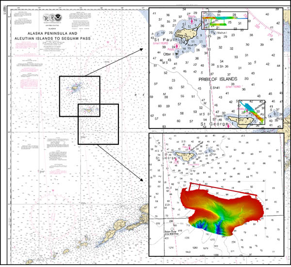
Figure 1. The survey area in the eastern Bering Sea included Pribilof Canyon and two relatively small and shallow areas near the Pribilof Islands. Both water depths and seabed backscatter were measured with high-resolution multibeam echosounders. Depths are represented above in shades of gray ranging from light gray (shallowest) to gray-black (deepest).