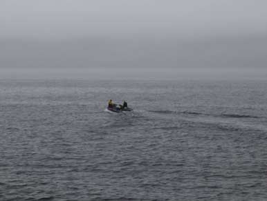
AFSC researchers head out into foggy Izhut Bay, Alaska, to conduct nearshore sampling. Photo by Martin Dorn.
During 2013 researchers from the AFSC repeated a series of six seasonal inshore surveys that were conducted in 2011. These surveys involved studying fish distributions and oceanography in 11 bays along the Gulf of Alaska coast and were conducted as part of the Gulf of Alaska Integrated Ecosystem Research Program (GOAIERP). The surveys occurred on a seasonal basis (spring, summer, and fall) and occurred in two regions: an eastern region that covered the outer coast of Southeast Alaska and a western region comprising the east coast of Kodiak Island and the southern coast of the Kenai Peninsula.
Major research activities during the survey included conducting nearshore beach and purse seines, acoustic transects, and sampling at oceanography stations. Small fishing vessels (50-80 ft) were used for much of this work, and the remainder was carried out in a smaller 16-ft inflatable skiff.
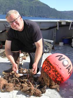
AFSC biologist Olav Ormseth inspects biological fouling on a recovered oceanographic mooring. Photo by Martin Dorn.
Although most of the data have yet to be analyzed, things were quite a bit different in the bays during 2013 relative to 2011. While most of the same species were present, some (such as age-0 Pacific cod) were less abundant than in 2011. Others (such as juvenile herring) were more abundant. Distributions were also different; for example, juvenile herring and sand lance were found at more sites in 2013 than in 2011.
An innovation for 2013 was the deployment of small oceanographic moorings in two of the bays, Salisbury Sound (east side) and Port Dick (west side). These “minimoorings” were simpler versions of the large moorings that oceanographers deploy in offshore areas. Two data logging CTDs (conductivity-temperature-depth recorders) were mounted on each mooring, one just below the surface and one at approximately 150 feet depth. These sensors gave us temperature and salinity readings every 10 minutes from April through October, and the data will be very important for understanding seasonal cycles in those two areas.
An unusual (and hopefully not to be repeated) aspect of the 2013 field season was the federal government shutdown 1-17 October. Unfortunately this was smack in the middle of our fall field season- indeed, we had to stop our first (east side) fall survey midway through and return home. Our second (west side) fall survey started several weeks later than planned and had to be curtailed due to the shutdown and other pre-existing commitments. While we were able to complete enough of these two surveys to allow our seasonal and interannual comparisons, it was a major blow to not be able to finish our work as planned.
Fieldwork for the GOAIERP is now complete, and we turn to the task of completing laboratory analyses of field-collected samples, exploring our data, and writing up our results.